
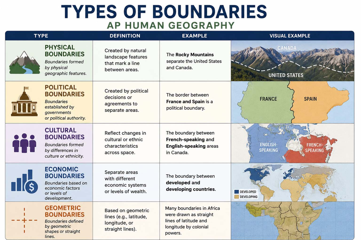
Political borders shape countries, cultures and conflicts, so the types of boundaries AP Human Geography covers show up again and again on the exam. Because the topic confuses many students, this guide explains each type in plain words, with a clear example and a simple memory trick.
First, you will learn the six origin types: antecedent, subsequent, superimposed, relic, geometric and consequent. Next, you will see how a border moves from a treaty to a map and then to the ground. Finally, you will learn how disputes start and which mistakes students make most often.
What Are the Types of Boundaries in AP Human Geography?
A political boundary is a line that separates one country, state or other political unit from another. Also, it shows where a government has authority and where that authority ends.
The types of boundaries in AP Human Geography fall into three simple groups. First, origin types explain when and why a border formed. Second, process types explain how a border moves from an agreement to a managed line. Third, dispute types explain why neighbors argue over a border.
Boundaries matter because they affect trade, migration, security, resources and national identity. For example, a mountain range can split people physically. However, a straight line can cut through a community that shares one language and one religion.
Most students lose points because they mix these groups together. A border can be geometric (its shape) and open (how it works today) at the same time. Therefore, always ask which question the exam is asking: how the border formed, how it was set up, or how it works now.
Six Types of Boundaries in AP Human Geography by Origin
The easiest way to tell these six apart is to ask when the border formed and who shaped it. Use this table as a quick guide, then read each type below.
| Type | Key idea | Common example |
|---|---|---|
| Antecedent | Drawn before major settlement | Western part of the US–Canada border (49th parallel) |
| Subsequent | Drawn after settlement and adjusted over time | Northern Ireland–Republic of Ireland border |
| Superimposed | Forced on a region by outside powers | Many African borders drawn by Europeans in the 1800s |
| Relic | No longer active but still visible | Berlin Wall and the Great Wall of China |
| Geometric | Follows a straight line or arc | US–Canada border along the 49th parallel |
| Consequent | Drawn to match cultural differences | 1947 partition of India and Pakistan |
Antecedent Boundary
An antecedent boundary forms before people heavily settle an area. Then, communities grow up around the existing line. Because the border came first, it did not need to follow any culture, since little culture existed there yet.
The western part of the US–Canada border along the 49th parallel is a common example. However, timing is the key idea, not the landscape. Therefore, ask one question: did the border exist before the human landscape developed?
However, textbooks sometimes label the same border in more than one way. For example, the 49th parallel is also geometric because it is a straight line. In that case, answer the question the exam asks: timing points to antecedent, and shape points to geometric.
Subsequent Boundary
A subsequent boundary forms after people have already settled the land. Governments and neighbors then draw or change the line to fit the situation. Over time, talks, wars or treaties may shift the border.
The border between Northern Ireland and the Republic of Ireland is a common example. The former Yugoslavia is another example. In both cases, settled communities existed before the lines took their final form.
Remember the order: settlement first, boundary later.
Superimposed Boundary
A superimposed boundary is forced on a region by an outside power. Instead, the power ignores the cultural patterns of the people who already live there. For example, colonial rule gives the best-known cases.
Many African borders drawn by European powers in the 1800s fit this type. Borders drawn in the Middle East after World War I are another example. As a result, one cultural group can end up split between states, while rival groups can end up inside one state. This can cause tension later.
However, not every straight border is superimposed. Instead, look at who drew the line and whether they considered the local people.
Relic Boundary
A relic boundary no longer works as an official border, yet people can still see its effects on the landscape or in culture. The Berlin Wall is the example teachers use most. Germany is no longer divided, but the old division still matters in history and memory.
Students often need a second example. The Great Wall of China works well because it no longer marks a working political border, but travelers can still see it. Therefore, remember the idea rather than one example: look for an old border that has stopped working but still leaves marks.
Geometric Boundary
A geometric boundary follows a straight line, an arc, or a line of latitude or longitude. Instead of following rivers, mountains or cultural groups, it follows the line. On a map, these borders look unusually straight.
The US–Canada border along the 49th parallel is a clear example, and parts of the US–Mexico border also run in straight lines. Geometric describes the shape of the border, but superimposed describes who imposed it. Therefore, a geometric border is not always superimposed.
Consequent Boundary
A consequent boundary is drawn to match cultural differences that already exist, such as religion, language or ethnicity. So leaders try to reduce conflict by placing the line where the cultural divide already is. The 1947 partition of India and Pakistan is a common example, since religion guided the new border. South Sudan, which became independent in 2011, is another.
Also, exam questions often ask which cultural pattern shaped the border. For that reason, name the pattern in your answer, such as religion or language, and not just the label.
Subsequent vs. Consequent Boundaries
Students mix these two up because both form after settlement. In fact, some textbooks treat consequent as a more specific kind of subsequent. Use this simple split:
- Subsequent: formed after settlement, and it may change over time.
- Consequent: formed after settlement, and placed to match a cultural divide.
Therefore, if the question stresses a religious, language or ethnic divide that shaped the line, choose consequent. If it only stresses that the border came after settlement, choose subsequent.
Defined, Delimited, Demarcated and Administered Boundaries
First, the origin types explain when a border formed. Next, these four steps explain how governments set up and run a border.
- Defined: the countries agree on the border in a treaty or another legal document.
- Delimited: the agreed border is drawn on a map.
- Demarcated: posts, fences, walls or signs mark the border on the ground.
- Administered: the government manages the border with checkpoints, customs and rules for movement.
Also, a simple memory line is: agree, map, mark, manage. Because these steps describe a process, they are not the same as the origin types. For example, a border can be antecedent and administered at the same time.
Open and Closed Boundaries
Next, think about how easily people and goods cross a border today. An open border lets people and goods cross with few limits, so travel is easy. The Schengen Area in Europe is a well-known example, since it allows passport-free travel between many member countries.
In contrast, a tightly controlled border uses fences, surveillance and checkpoints. For example, the Korean DMZ is a heavily controlled zone.
Openness describes how a border works. However, it is not one of the origin types of boundaries in AP Human Geography. Therefore, do not mix it up with antecedent or superimposed.
Four Types of Disputes Over Boundaries in AP Human Geography
Because borders affect land, money and power, neighbors argue about them for four main reasons. Therefore, geographers group these reasons into four types of disputes.
- Definitional: the countries disagree about the words in the legal document that defines the border. For example, Chile and Argentina have disagreed about where the crest of the Andes lies.
- Locational: the countries agree on the definition but disagree about exactly where the line sits on the ground.
- Operational: the countries disagree about how the border should work. For example, Lebanon, Jordan and Turkey faced debate over how to handle Syrian refugees at their borders.
- Allocational: the border crosses valuable resources, so countries argue over who may use them. For example, in 1990, Iraq accused Kuwait of slant drilling into its oil reserves, and the dispute contributed to the Gulf War.
First, read the scenario carefully. Then ask whether the problem is the wording, the location, the operation or the resources.
Maritime and Internal Boundaries
Boundaries also exist at sea and inside countries. First, under the United Nations Convention on the Law of the Sea (UNCLOS), a coastal state controls a territorial sea that reaches 12 nautical miles from its coast. Then, beyond that, the state holds sovereign rights over resources in an exclusive economic zone (EEZ) of up to 200 nautical miles. However, other countries keep freedom of navigation there.
Because fish, oil and shipping routes lie in these waters, maritime disputes are common. The treaty took effect in 1994.
Second, internal boundaries divide land inside one country, such as states, provinces and voting districts. Governments use them because they need clear areas for administration and representation. For example, redistricting changes where voting district lines run, so it can affect political power.
How to Remember the Types of Boundaries in AP Human Geography
Use these short memory lines for the six origin types:
- Antecedent: before settlement.
- Subsequent: after settlement.
- Superimposed: an outsider forces it.
- Relic: an old border that is still visible.
- Geometric: a straight line.
- Consequent: matches culture.
Then follow these steps when you study:
- First, read the definition.
- Next, say what makes the type different.
- Then match it with one example.
- Also, find the example on a map.
- Next, explain why the example fits.
- After that, compare it with the type you confuse most.
- Finally, test yourself without your notes.
Because this method builds reasoning and not just recall, it works better than memorizing word lists. A good study plan also helps. For tips on organizing your notes, read this guide on how to create a study guide before exam week.
Common Mistakes Students Make
- Mixing up antecedent and consequent boundaries.
- Confusing subsequent and consequent boundaries.
- Calling every straight border superimposed.
- Treating relic boundaries as active borders.
- Mixing up delimited and demarcated boundaries.
- Confusing how a border formed with how it works today.
- Memorizing examples without knowing why they fit.
Therefore, always explain the reason behind your answer. A short reason such as “the border was drawn before settlement” shows the grader your thinking.
Practice Questions on Types of Boundaries in AP Human Geography
Try to name the type before you read the answer.
Situation: A border is set before an area is heavily settled.
Answer: Antecedent boundary.
Situation: An outside colonial power draws a border and ignores local cultures.
Answer: Superimposed boundary.
Situation: A former border no longer works but still leaves marks on the landscape.
Answer: Relic boundary.
Situation: A border follows a straight line of latitude.
Answer: Geometric boundary.
Situation: A border is placed to match a religious divide.
Answer: Consequent boundary.
Situation: Officials draw an agreed border on an official map.
Answer: Delimited boundary.
Situation: Workers place posts and fences along the mapped border.
Answer: Demarcated boundary.
Situation: Two countries disagree about who may use oil that lies under their border.
Answer: Allocational dispute.
For official course details, visit the College Board AP Human Geography course page. Many students also study several AP courses at once. If that sounds like you, this AP Psychology study guide shows another way to plan your review.
Frequently Asked Questions
What are the main types of boundaries in AP Human Geography?
First, the six main origin types are antecedent, subsequent, superimposed, relic, geometric and consequent. Also learn the four process steps (defined, delimited, demarcated and administered) and the four dispute types.
What is the difference between delimited and demarcated boundaries?
A delimited boundary is drawn on a map, while a demarcated boundary is marked on the ground with posts, fences, walls or signs.
What is a relic boundary example other than the Berlin Wall?
For example, the Great Wall of China no longer works as a political border, but people can still see it.
Is a geometric boundary always superimposed?
No. Geometric describes the shape of the line, while superimposed describes who imposed it. A border can be geometric without an outside power forcing it.
Which types of boundaries in AP Human Geography do students confuse most?
Students most often confuse subsequent and consequent boundaries, and delimited and demarcated boundaries. Antecedent and consequent also get mixed up. Therefore, compare each pair side by side and explain the difference in one sentence.
Key Takeaways on Types of Boundaries in AP Human Geography
Because the exam tests reasoning, mastering the types of boundaries AP Human Geography covers means knowing how each border formed, how governments set it up and how it works today. First, learn the six origin types. Next, learn the four process steps and the four dispute types.
Finally, practice with maps and short scenarios, and always explain why an example fits. As a result, you can handle unfamiliar questions with confidence.
Checks I ran